South Coast Track

The walk is 85 kilometers in total but what it lacks in distance it makes up for in mud, buttongrass and dense thickets of tea-tree. There’s also some breathtaking scenery but mostly the track is a bit of an endurance test to see how you cope with lugging yourself and your gear across the wilderness.
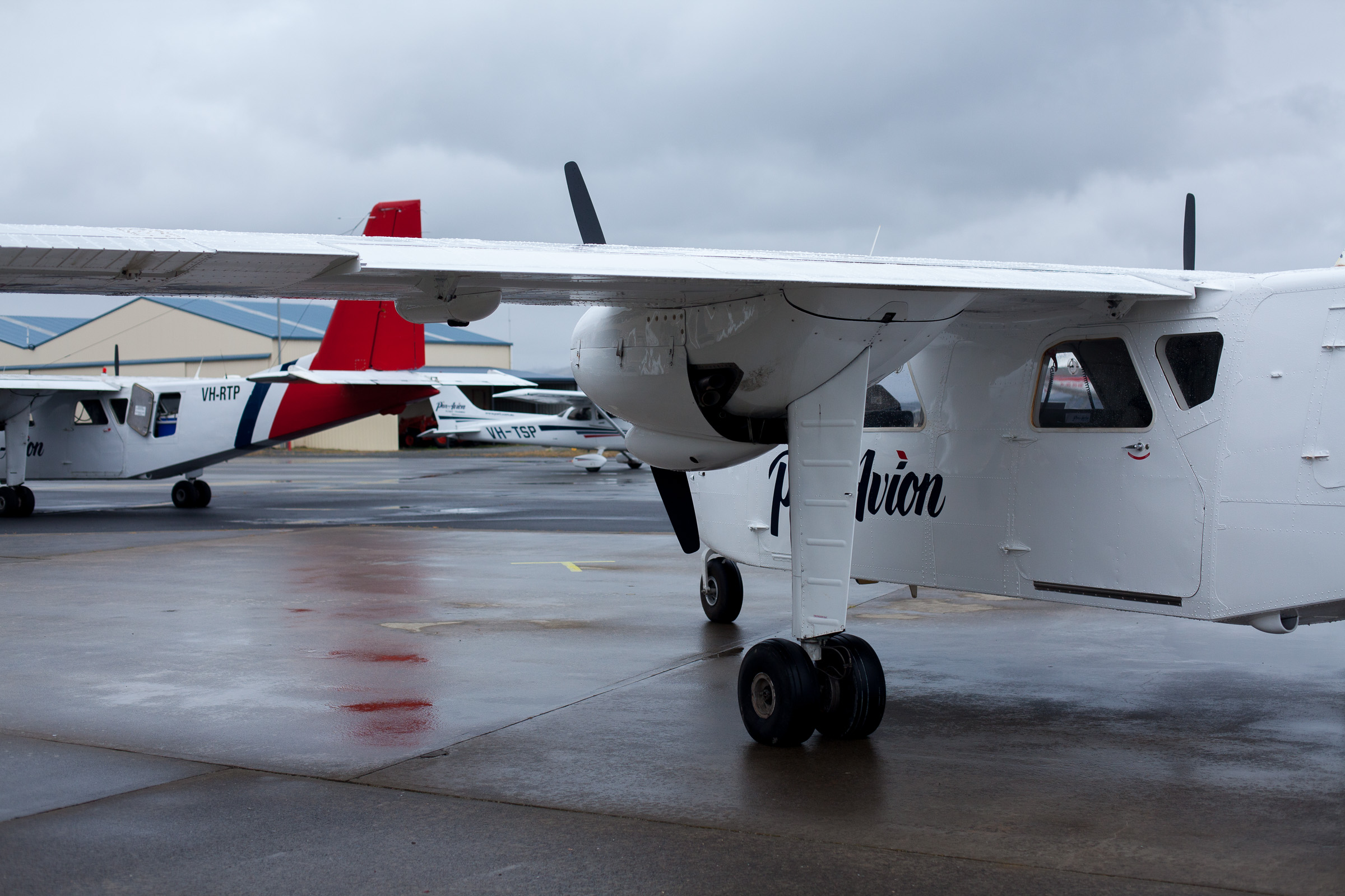
Tom, Dave, Jim and I had decided to walk the track in early February to give ourselves the best chance for fair weather. We’d chartered a flight with Par Avion which operates from a little aerodrome near Hobart airport and we spent our last night in the city carefully weighing our packs and making the necessary sacrifices to keep to the strict 20kg luggage limit. The next morning we crammed ourselves and our gear into the belly of a little twin-engine Islander aircraft and set off into the low clouds south of Hobart. Space being at a premium they put me in the navigator’s seat up front. The instruments and the flight controls all looked pretty similar to what you’d find on the dashboard of an 85 Corolla. I’m pretty sure something was held down with tape.
Before long we were flying alongside the south coast with the last signs of civilisation being offshore salmon pens. After that it was nothing but forest and ocean with little glimpses of the bays we’d be walking on our way back. The realisation that every kilometer we flew west we would have to re-trace on foot really drove home what we were attempting. There are no roads into the South West National Park. Apart from Cockle Creek, our final destination, the nearest point that vehicles can access is Scott’s Peak Dam about four or five days walk from the trailhead at Maleleuca.
We flew low under the cloud cover along the coast for a little while. Tom had warned us that we’d have to walk inland and climb the Ironbound Range in the middle of the walk- the rest of the track being fairly flat. I wanted to know why the track didn’t just hug the coast the whole way. When we flew past the mountains I understood why. The south face of the range was completely exposed- just wet grey rock and ocean churned white at the base of the cliff. The top of the range was hidden in the clouds.
Not long after that we swung north and set down on the gravel airstrip in Maleleuca. A small group of people in brightly coloured parkas were awaiting our arrival. Due to weather our flight had been pushed back by a day which had meant the few hikers who had walked the trail from east to west had waited out the storm in huts by the airstrip. They were eager to get out and the Par Avion pilot was eager to get airborne before the weather turned again. Tom ran into an old colleague at the huts and we got her to take a nice ‘before’ photo of us in our pristine hiking gear. Our little taxi was in the air before we even left the airstrip and then we were headed south to Cox Bight and our first campsite.
The airstrip was laid out by the famous bushman and naturalist Deny King in the 1950s. He lived in Maleleuca for most of his life, mining alluvial tin with hand tools and minimal support. After serving as an engineer in the war he had a small bulldozer shipped in and he cleared the space for the airstrip.
The weather was ideal for our first day of walking- overcast and cool with a light wind. The first leg of the track wasn’t too strenuous but we were still starved by the time we set up camp by the coast. That night we took stock of our food supplies (mostly dhal and cous-cous). We divided up the food into meals for the seven nights we estimated the walk would take. What had looked like a lot of food on the table in Hobart now didn’t seem like anywhere near enough after working up an appetite walking several kilometers with heavy packs. If we skipped the rest day, Jim suggested, we could do the walk in six days and eat more each night. That plan was met with general agreement. Then we broke out the guide book and looked at the spread of campsites and blithely estimated that we could probably skip one camp altogether. That settled, we ate one fifth of our dinner supplies and committed ourselves to a much more serious pace.
The next day we set out early. The track took us over the Red Point hills which was the first test for my legs which hadn’t been asked to do much more than bicycle to work for the previous couple of years. We were all aching and soaked with sweat when we reached the top. The only thing the summit afforded us was a good view of the much more imposing Ironbound Range that we’d be hiking over the following day. The walk down the other side was a gentle one, slowly taking us through the exposed buttongrass plain into a dark and dense rainforest alongside the Louisa river. We crossed the first of many streams in the forest and the tannin-stained water was somehow colder than any snow runoff I’ve ever experienced. Tom and I opted to avoid submerging our boots this early in the walk while Jim and Dave just embraced the inevitable and powered through.
The campsite was at a bend in the Louisa River under some immense old-growth eucalypts with an understory of ferns. It was dark and still and beautiful but it was swarming with mosquitoes. After dinner I walked further up the track, out of the forest and up one of the foothills of the Ironbounds to watch the sunset.
The next day was again overcast and cool. Perfect weather for our climb. We went up the mountainside with a growing appreciation for the crew who had put the track itself in place. The western approach to the Ironbounds takes you 900 vertical meters over the course of about 5 kilometers. The track was first cut in late 1800s as a shipwreck escape route and the modern gravel and timber steps on the west face of the Ironbounds are an achievement unto themselves.
We climbed for a few hours, stopping occasionally to admire the view all the way out past Cox Bight to the South West Cape Range. Looking South you could see the Maatsuyker Island chain which forms the most southern point of the continent. From there it’s just two and half thousand kilometres to the edge of Antarctica. After more steady climbing we slipped into the cloud cover. The closer we got to the top the more exposed the track became until we were leaning into the wind and rain. Dave, possibly delirious, did a few celebratory burpees at the summit wearing his full pack and then we hurried down into the shelter of the rain forest on the eastern face.

That was where the real difficulties started for me. The descent consisted of hours of stepping down through wet rocks, muddy slopes and polished roots. At some stage my knees started giving out and Jim lent me his hiking pole so I wouldn’t slip and turn an ankle. In the afternoon we reached the campsite at Little Deadman’s Bay and the feeling of shedding the pack was glorious. We shed the rest of our clothing and waded into the kelp to wash off the sweat.
That evening we met the first hikers coming in the opposite direction. A wiry looking lady and her cheery teenage daughter from Darwin proved themselves to be far better prepared than we were. They had a different dehydrated meal for each night and had already taken detours from the main track to explore other bays and lookouts on the way. Having not yet recovered from the days effort the idea of voluntarily adding kilometers to the journey seemed like some sort of heresy. The second set of walkers were much more solemn. They’d had to part company with one of their companions the previous day after he’d fallen and dislocated his shoulder. Unable to carry his pack they’d had to set off their EPIRB and wait for a helicopter to evacuate him. We gave them our impression of the track ahead of them, turned in early and slept like the dead.
The next day was supposed to be the rest day and our legs definitely needed it but we set off for the sake of our stomachs. We walked mostly along the beach nursing blistered and bruised feet until we arrived at New River Lagoon. The crossing requires you to ferry yourself and your belongings across a wide inlet on a rowboat and then row back with a second boat to ensure there was always one boat on each side for the next set of walkers. The task is a bit like the riddle about getting a fox, a hen and a bag of grain across a river in three trips. The unspoken assumption being that Dave could not be left alone with Jim or he would eat Jim. It was low tide at the lagoon and it was hard work pushing the boat through the wet sand so it could be secured on the east side. At least, I assume it was hard work. I stood back and filmed while the others hauled it across the mud. When it was finally secured Tom realised he’d left Jim’s hiking pole on the other side of the river. He looked at it mournfully through the binoculars but there was no discussion of pushing the boat back down to the water and going back.
From there we walked to Surprise Bay (however we had a GPS unit, so it wasn’t). Sandpipers and Oystercatchers were combing the beach in the late in the evening and we settled in at a very picturesque campsite perched on the headland to watch the sun go down over the bay.
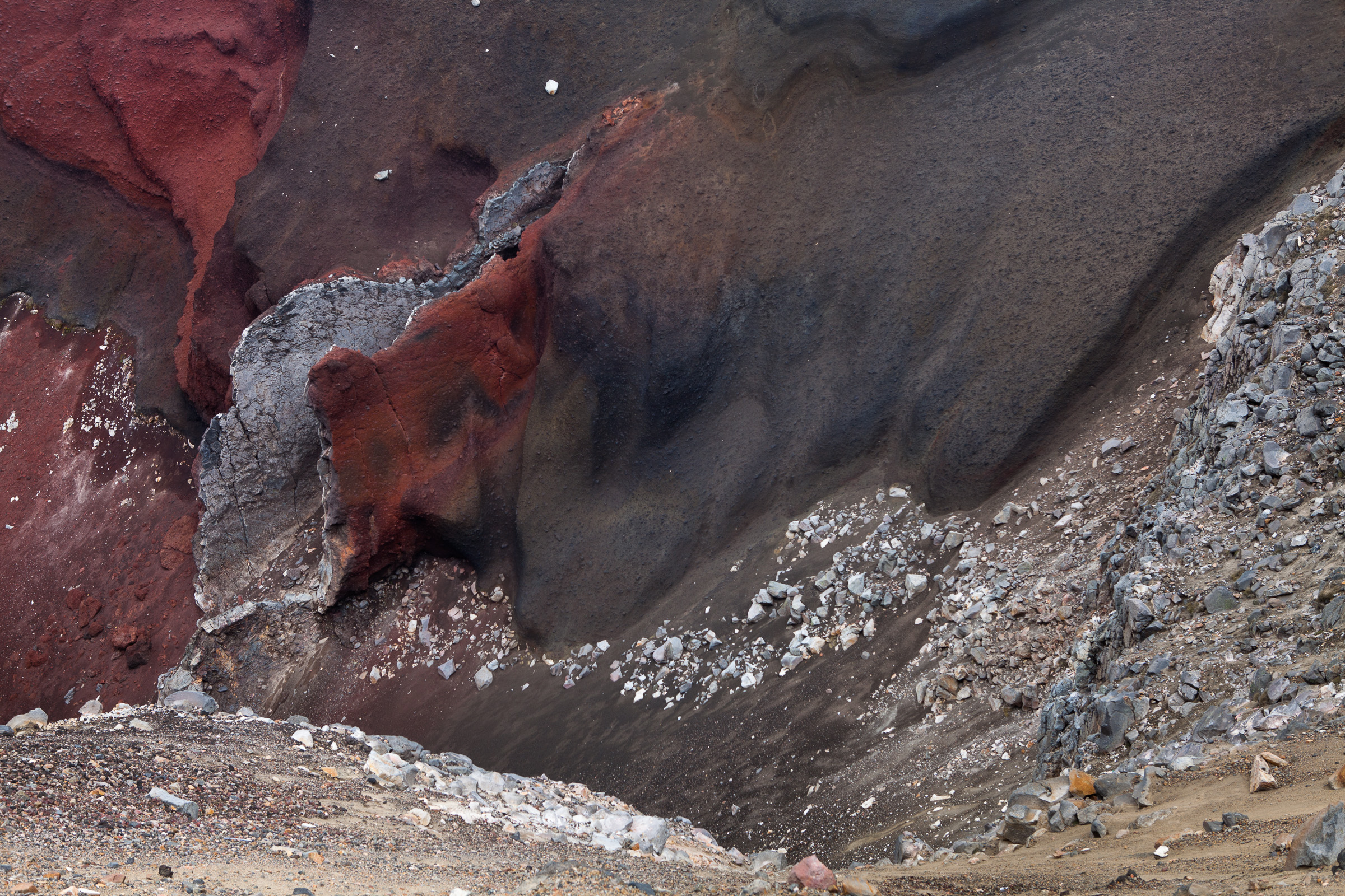
The next day started with rock-hopping along granite beach and a climb up a waterfall followed by a gruelling slog through tea-tree and mud over the South Cape Range. More than at any other point I realised why the track could be dangerous. In poor weather it would be incredibly easy to get lost in the tea-tree. Threading through the undergrowth plays hell with your sense of direction. Even in clear daylight we departed from the track on several occasions as it disappeared into swamps and detours led us into thicker and thicker scrub. None of us were trying to keep our feet dry by this stage so we waded through mud and hauled ourselves through the undergrowth at a glacial pace almost looking forward to the steep sections of bush that were at least firm underfoot.
Finally we arrived at South Cape Rivulet and our last campsite. The first sign of civilisation we came across were a pair of cray-boats moored far off in the distance. We rinsed the mud off our boots and hung up everything to catch the last bit of sunlight at the end of the day while a pair of pademelons investigated our camp.
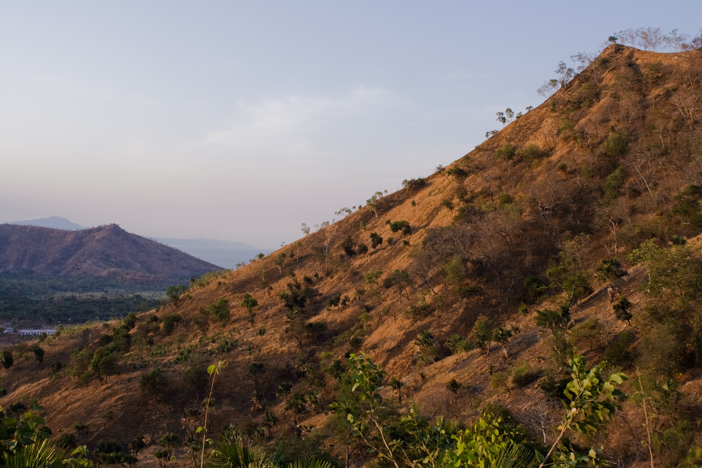
The last day was an easy 11km hike back to Cockle Creek. Walking ahead I came across a solitary surfer on a cliff overlooking the South Cape. He had a sports bag filled with canned beans and loose camping supplies. The ocean below him looked fierce, with big barreling waves crashing over the rocks before being sucked out through deep channels. He wasn’t very talkative so I wished him luck and then headed inland over the flat open heath of Blowhole Valley then into light forest to the track end at Cockle Creek.


Leave a Reply